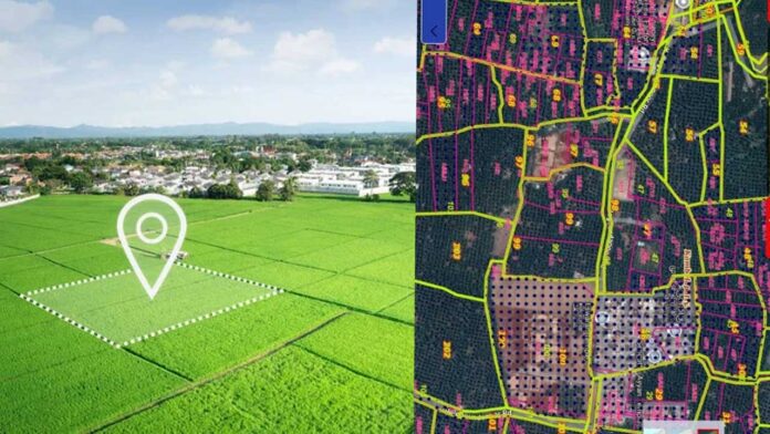
A farmer, a techie, and a revenue officer now have one thing in common—the Dishaank app on their phones. In a time when land disputes can ruin lives and legal cases drag for decades, this small digital tool brings coordinates, clarity, and credibility to one of India’s most complex sectors—land records.
What Is the Dishaank App Really About?
At its core, Dishaank is a geospatial tool developed to make land survey data publicly accessible. It’s not merely a mapping application but a mobile interface that connects end users to the digitized Survey Settlement and Land Records (SSLR) of Karnataka. It integrates the entire land information system into a smartphone-sized gateway.
Bridging Legacy with Location
Historically, land documents in India relied heavily on manual ledgers, hand-drawn maps, and verbal claims. The Dishaank app dismantles this opacity by layering official cadastral maps with GPS technology. It doesn’t just tell you who owns a piece of land—it locates it with satellite-level accuracy and overlays legal boundaries.
Designed with Governance in Mind
Though available to the public, Dishaank wasn’t created for real estate agents or investors alone. It was engineered to assist revenue officers, surveyors, and local officials in verifying ground-level data on the go. The backend runs on Karnataka’s Bhoomi database, bringing decades of legacy documents into the digital realm.
Why Accuracy Matters More Than Ever
In a land conflict, one misplaced boundary line can mean acres of ownership dispute. Dishaank minimizes such errors by providing real-time positional data. It offers not just map visuals but coordinate precision. For users, this accuracy translates into faster transactions, stronger documentation, and fewer court-bound conflicts.
Empowering the Common Citizen
Dishaank is not gated behind bureaucratic processes. Any citizen can download the app and check land information using survey numbers. This has rebalanced power dynamics. Tenants, farmers, or rural families no longer need middlemen to know who owns what. A few clicks reveal ownership status, dimensions, and usage type.
Security Through Data Integrity
All data in the Dishaank app comes from government-certified sources, making it legally trustworthy. It reduces chances of document tampering, repeated property entries, and fake ownership claims—problems that have long disrupted rural and real estate transactions. This level of integrity reduces the scope for fraud in both urban and rural spaces.
A Tool for Legal Verification
Lawyers and notaries are beginning to treat Dishaank as a primary source for pre-registration verification. Instead of manually collecting village maps and revenue documents, they now rely on the app to cross-check ownership and land classification before contracts are drafted. This saves time, reduces risks, and builds client confidence.
Dishaank in Urban Planning
Though initially aimed at rural survey accuracy, urban planners are beginning to use Dishaank for land use insights. The app helps spot encroachments, outdated zoning, or mismatches between municipal claims and revenue department records. For local governments, this means cleaner town maps and better infrastructure rollout.
Education Meets Empowerment
Schools in Karnataka have started using Dishaank to teach students how to read maps, analyze coordinates, and understand land ownership structures. This isn’t just digital innovation; it serves as a hands-on introduction to land governance and citizen rights. Students in rural areas especially gain first-hand exposure to how land governance works and how tech can demystify it.
The GIS Layer Advantage
Dishaank is built over GIS (Geographic Information System) layers, which enables it to do more than show ownership. It can detect terrain type, water bodies, buffer zones, and more. This makes it useful not just for individual buyers, but also for government planning, ecological monitoring, and disaster management.
Download App
Real Estate Validation on the Go
Prospective buyers can now stand on a piece of land, open Dishaank, enter the survey number, and know if the property being sold is legitimate. It prevents misinformation and saves people from buying disputed or misclassified land. In essence, it places real estate validation in the user’s own hands.


